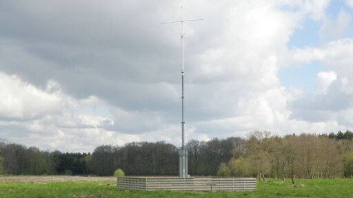
There’s an already-extant ground-based vessel navigation system, Loran-C, though I’m sure that it’s possible to improve on it and I have no idea how much of the receiver hardware is still out there.
https://en.wikipedia.org/wiki/Loran-C
The introduction of civilian satellite navigation in the 1990s led to a rapid drop-off in Loran-C use. Discussions about the future of Loran-C began in the 1990s; several turn-off dates were announced and then cancelled. In 2010, the US and Canadian systems were shut down, along with Loran-C/CHAYKA stations that were shared with Russia.[2][3] Several other chains remained active; some were upgraded for continued use. At the end of 2015, navigation chains in most of Europe were turned off.[4] In December 2015 in the United States, there was also renewed discussion of funding an eLoran system,[5] and NIST offered to fund development of a microchip-sized eLoran receiver for distribution of timing signals.[6]
The National Timing Resilience and Security Act of 2017, proposed resurrecting Loran as a backup for the United States in case of a GPS outage caused by space weather or attack.[7][8]
Similar to cellphone a-gps (assisted gps) with a supplemental unified NLP (network location provider) addon feature found on recent phones… but beefed-up on a large-scale. This should provide more emitter sources, whitelisting and blacklisting, and dedicated software to help discover bad or rogue emitters.
I’m going off the graphic guessing the “detectors” continuous scanning contributes into a database that users will then subscribe on to; instead of the cellphone makeing the self-processing decisions in NLP software.
And what is Galileo supposed to be then?
It’s a satellite based nav system. This would be a new development that is presumably ground based.
It’s the same as GPS (American) or Glonass (Russian). Satellite based positioning, which is vulnerable to jamming. It could also be turned off, just like the others, hence the need for an alternative.
which is vulnerable to jamming
This has, in fact, been a serious problem in the Baltic region, as Russia’s military has been jamming GPS there for some time, and it dicks up navigation for ships and aircraft there.
Yes, a search for ‘GPS jamming Baltic’ turns up hits from everything from DW to the Financial Times.
It’s a problem for maritime and aviation navigation, and a problem for both sides in the war in Ukraine. Some drones are now using fiber optic tethers to get around the jamming, that’s not much of an option for civilian traffic though.
Upon actually investigating the article, it appears to mention it as well. :-)


